CASEarth Poles aims to construct a big data platform to better serve polar data acquisition, curation, integration, sharing and application; improve the understanding of the polar environment and climate; and support decision-making for polar sustainable development.
Unprecedented changes in the climate and environment have been observed in the three poles, including the North Pole, the South Pole, and the Third Pole-Tibetan Plateau. Although considerable data have been collected and several observation networks have been built in these polar regions, the three poles are relatively data-scarce regions due to inaccessibility, high-labor cost, and difficult living environments. To address the obstacles in better understanding the unprecedented changes in the three poles and their effects on the global environment and humans, there is a pressing need for better data acquisition, curation, and integration, services and application to support fundamental scientific research and sustainable development for the three poles. CASEarth Poles, a project within the framework of the “CAS Big Earth Data Science Engineering” program of the Chinese Academy of Sciences, aims to construct a big data platform for the three poles. CASEarth Poles will be devoted to (1) breaking the bottleneck of polar data curation, integration, and sharing; (2) developing high-resolution remote sensing products over the three poles; (3) generating atmospheric reanalysis datasets for the polar regions; (4) exploring the synchronization, asynchronization, and teleconnection of the environmental changes in the three poles; (5) investigating the climate, water cycle, and ecosystem dynamics and the interactions among the multispheres in the polar regions and their global effects; and (6) supporting decision making with regard to sea-ice forecasting, infrastructure, and sustainable development in polar regions. CASEarth Poles will collaborate with international efforts to enable better data and information services for the three poles in the big data era.
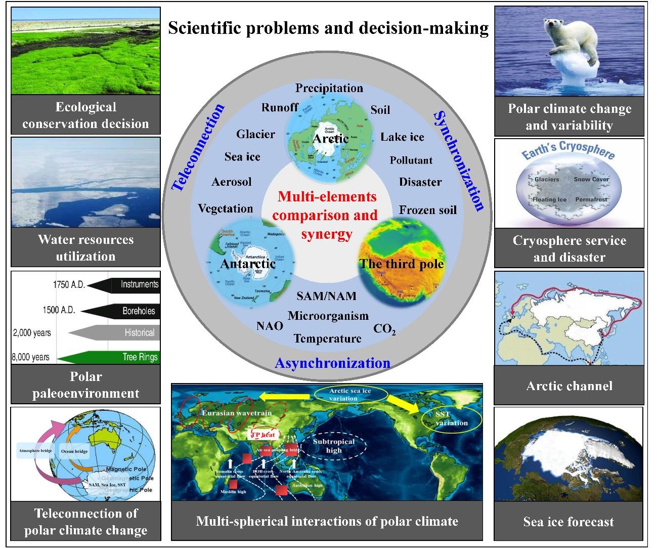
Figure 1 The research scheme of synergistic and comparative studies on the polar environment, spatial-temporal changes in the polar water and ecosystem, multispherical interactions of the polar climate systems, and cryosphere service and decision support for infrastructure in polar regions (Li et al., BAMS, 2020)
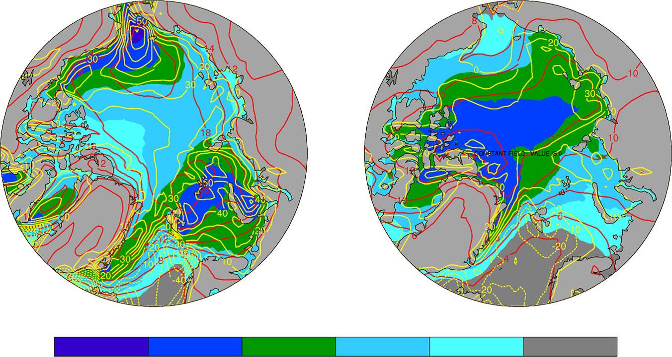
Figure 2 Centennial changes from CMIP5 models. a from 1970–1999 to 2070–2099 and b from 2070–2099 to 2170–2199 (Dai et al., NC, 2019)
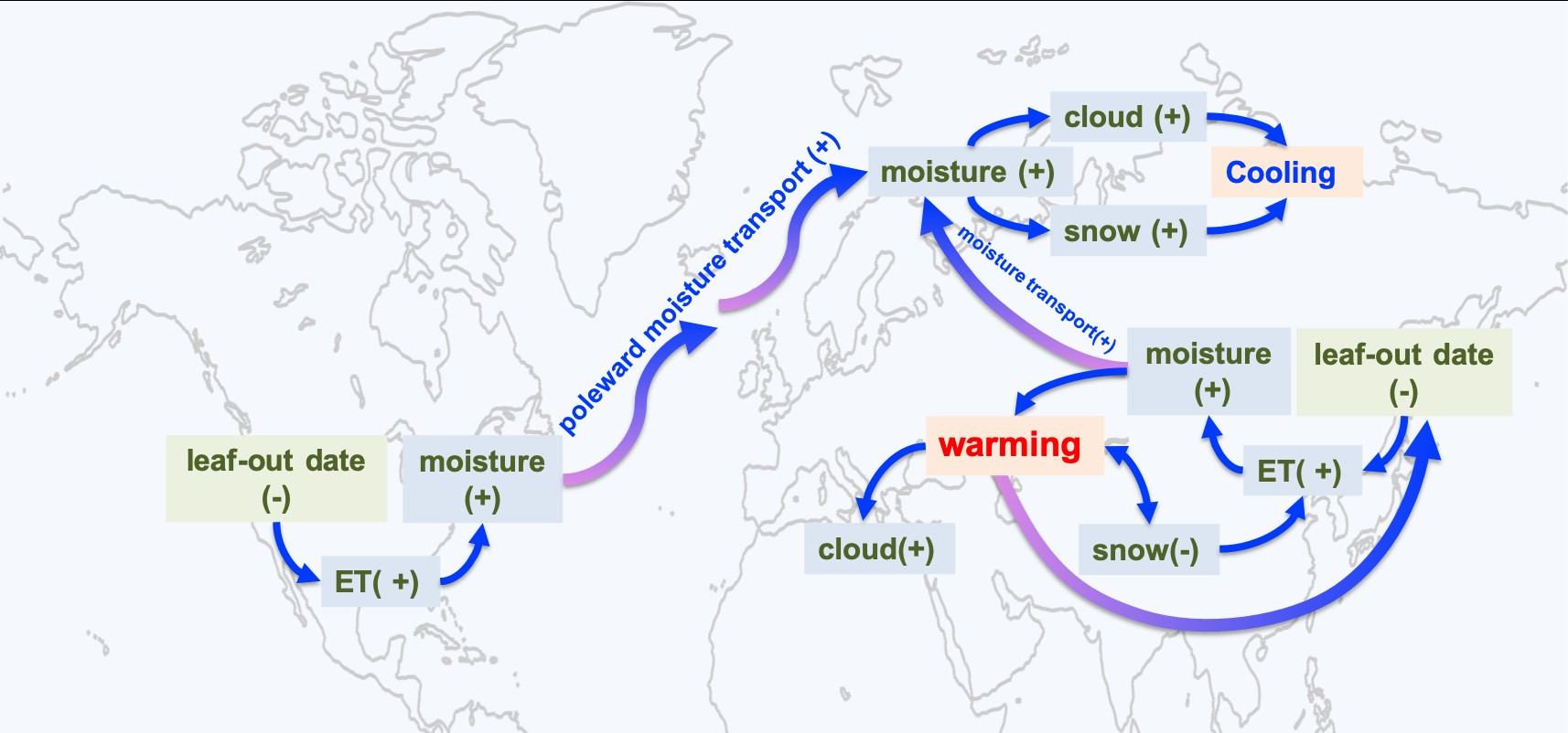
Figure 3 Illustration of a positive feedback between earlier leaf out and northern hemisphere warming (Xu et al., NCC, 2020)
Figure 4 Temperature sensitivity of SOM decomposition governed by aggregate protection and microbial communities (Qin et al., Science Advances, 2019)
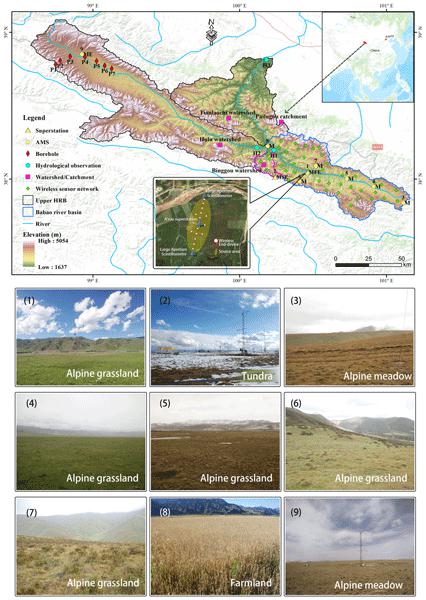
Figure 5 The integrated hydrometeorological, snow and frozen-ground data observation network located at the study site (Che et al., ESSD, 2019)