Many countries along the Belt and Road are facing challenges in sustainable development such as water shortages, frequent occurrences of disasters, and huge ecosystem changes. In the Belt and Road region, the speed of data processing and analyzing is much lower than the data acquiring, causing a mass of scientific data and information cannot be used conveniently.
Digital Belt and Road Program (DBAR) aims to establish an international Big Earth Data analysis and decision support system covering the Belt and Road region. The system will carry out scientific analysis of Big Earth Data for the Belt and Road to better understand the spatial distribution of regional resources and environments, development potentials and trends. It will also develop an SDG indicators evaluation system for 8 related goals and 33 indicators, to achieve the scientific monitoring of the major SDG indicators along the Belt and Road.
Supported by the program, 8 DBAR International Centre of Excellence (ICoE) are established in Thailand, Pakistan, Finland, Italy, Russia, Morocco, Zambia and the United States. Through a network of Centre of Excellence for collaborative research, it has achieved international collaborative innovation in collaborative data acquisition and verification, selection of SDG regional monitoring indicators, and the joint construction of the Big Earth Data system.
The launch of the program promoted the Big Earth Data applications for the UN SDGs decision-making support, and provided the Belt and Road regional demonstrations. The Program works as a reliable platform for international data exchange and sharing, cooperative research, and regional decision-making support along the Belt and Road.
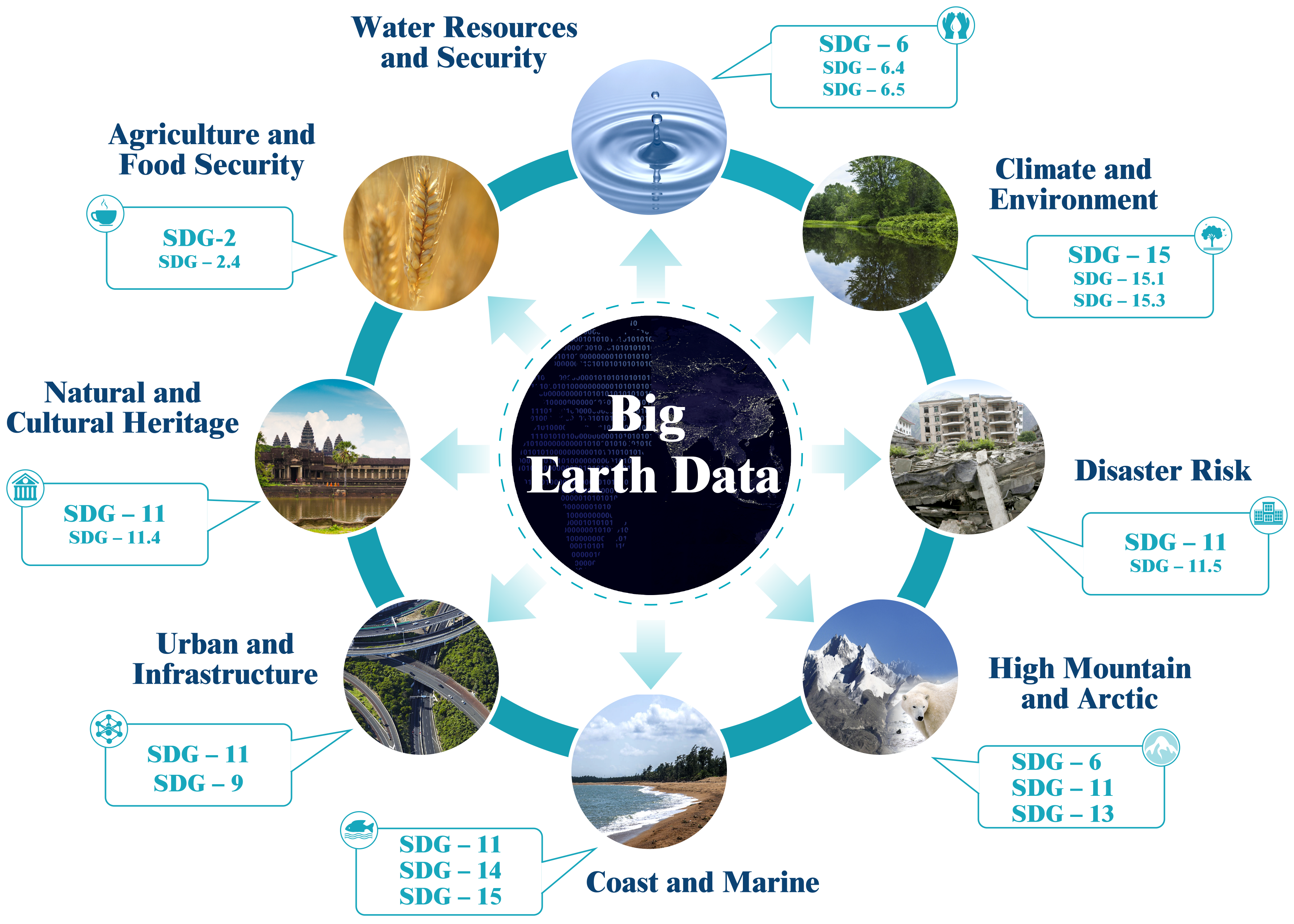
Figure1 Research topics for SDGs
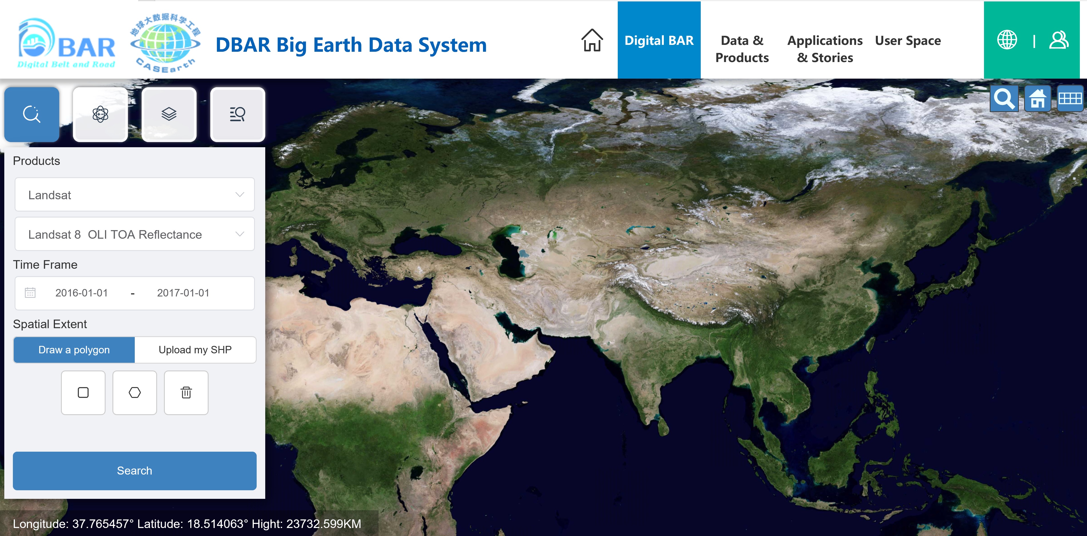
Figure2 DBAR Big Earth Data System 2.0
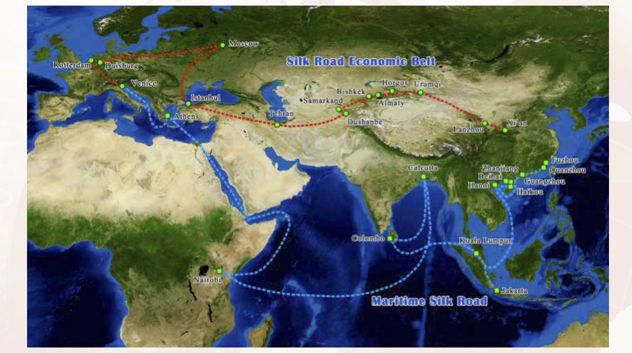
Figure3 Belt and Road region